
Background:
Phone map apps often have a few optional settings for a route, such as:
- Avoid highways (for driving)
- Fewer bus transfers (for public transit)
- Avoid hills (for walking)
The issue:
Sometimes, you want drive on the most scenic route from point A to point B, without too much concern about efficiency.
For example, you might want to impress an out-of-town guest, or hide the seedier parts of a city from a visiting foreign dignitary or investor.
Proposal:
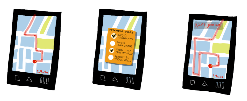
The “scenic route” to a destination attempts to route you through the highest-economic-value areas that it can find.
This method, called the “Potemkin Route” after the 1787 idea of the same name, uses the following data:
- Tax records (to find the highest property values)
- The police blotter (to avoid areas of high crime)
- Elevation maps (to look for scenic views)
Then, it routes you to the optimum area to show off the most appealing areas of the region near your route (user interface mockup in Figure 1).

Conclusion:
You could use this route yourself, even if you aren’t trying to impress a foreign dignitary.
PROS: Allows you to ignore the problems of your city.
CONS: Allows you to ignore the problems of your city.

You must be logged in to post a comment.