
Background:
Some modern countries are “missing” areas of territory that belonged to the ancestral inhabitants of their region.
This inspires citizens of that country to look at a map, compare it to an old map, and say “hey, we should invade that area and take it back over—it was ours in 1648, so it should be ours now!”
This is commonly called https://en.wikipedia.org/wiki/Revanchism or https://en.wikipedia.org/wiki/Irredentism, and specific examples exist for dozens of countries.
The Issue:
Unfortunately, it turns out that war is an expensive and deadly proposition. So it is typically avoided when that is at all practical.
Fortunately, most individuals don’t really need to interact with all that much land.
To the average citizen, it’s irrelevant whether their country is, say, the size of Greece (land area: 51,000 square miles) or Australia (3,000,000 square miles).
Imagine, for a moment, that you personally discovered a vast international cartographic conspiracy to conceal the fact that all of North and South America are, in fact, slightly smaller than Japan, and they’ve just been inflated in size by 100x on maps for the last 500 years. Although this would be an interesting discovery, it wouldn’t actually change anything—this “land area” number is totally irrelevant to people’s daily lives!
Yet people get very emotionally upset about perceived slights to their country. As evidence, see the famous 1934 image in Figure 1 that informs the viewer that “Portugal is Not a Small Country.”

Proposal:
If a country feels that it is larger than its neighbors, its citizens might feel magnanimity and tolerance toward its smaller neighbors, just as a person might feel a protective instinct for a defenseless tiny baby bird.
Thus, the solution is obvious: fake maps for each country, where the country’s own land area was inflated, and its neighbors were diminished. (It has occasionally been argued that the Mercator projection also coincidentally serves this function.)
As we can see in Figure 2, this works well: a Brazil-sized Portugal is now undeniably not a small country.

Handling complicated borders might be difficult, since “properly” magnifying a country while preserving border relationships would introduce a lot of distortion.
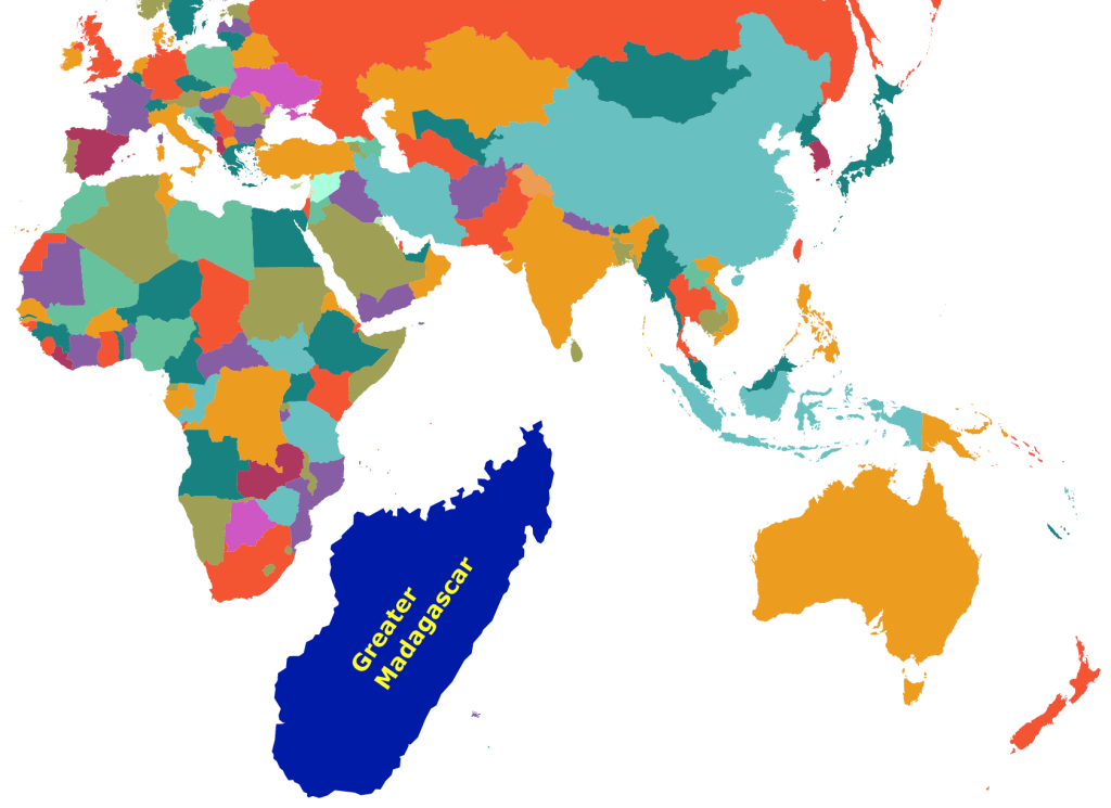
Fortunately, we at least have an easy solution for island nations, which can blithely make themselves gigantic with their favorite image editor’s “resize” tool. Observe the massive yet rarely-discussed island nation Greater Madagascar in Figure 2.
Conclusion:
A country could also resize its rivals to be smaller, rather than resizing itself. This opens up many additional forms of map manipulation.
If it turns out that larger countries are more belligerent (i.e., that the hypothesis above is exactly backwards), we could simply recommend that countries resize themselves to be smaller instead.
PROS: Promotes peace and provides much-needed jobs for cartographers.
CONS: Some countries may be difficult to resize due to a large number of neighbors. Certain islands also may defy resizing: for example, Cyprus’s maximum size is limited by the Mediterranean Sea.

You must be logged in to post a comment.